| pakistan
GARDENS OF THE SHARED INDUS RIVER BASIN
James L. Wescoat Jr.
LA 79 |
|
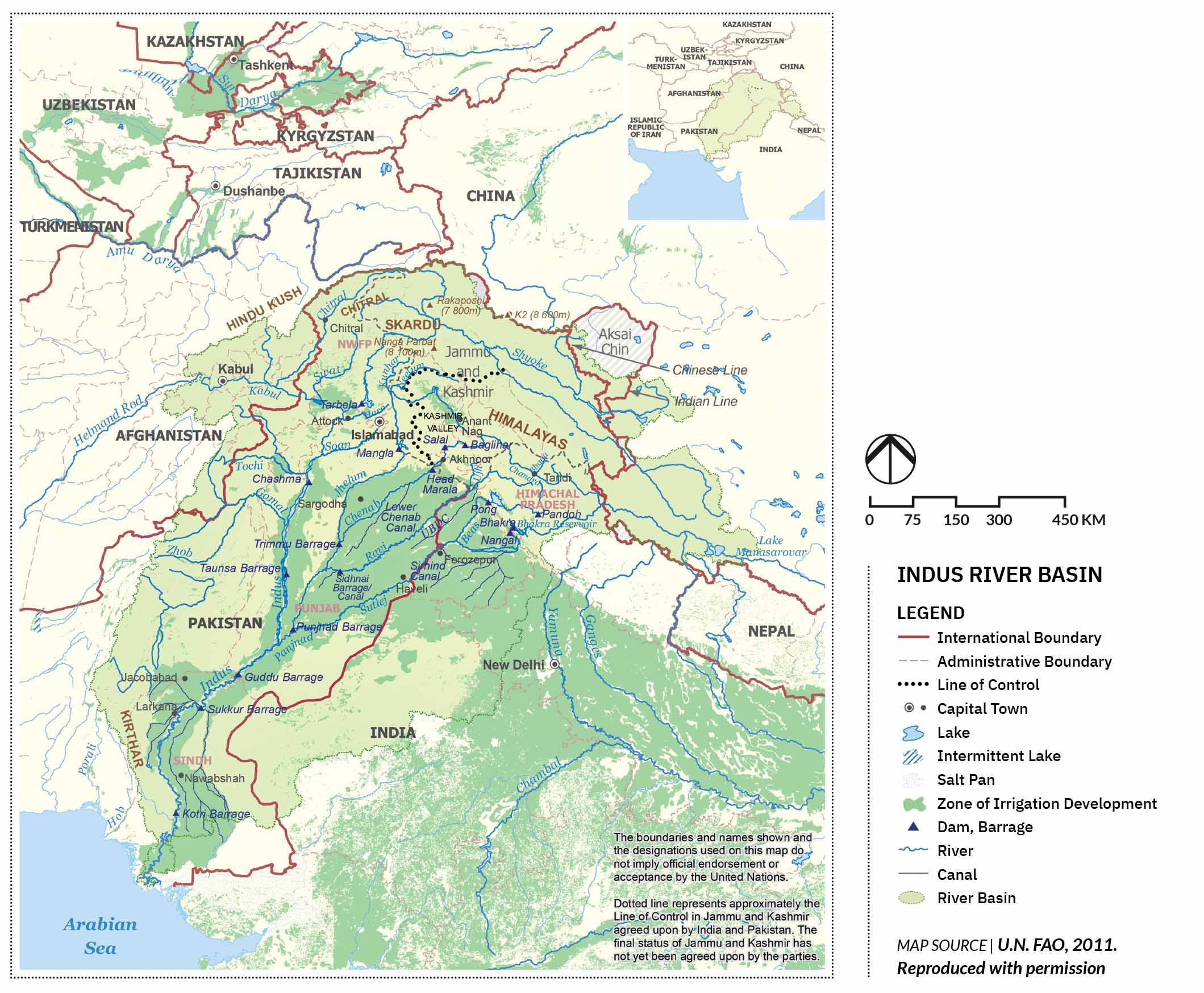
| The Indus River Basin spanning the regions of India and Pakistan, Afghanistan, and China with key features like historic gardens, and modern irrigation can integrate landscape design with climate adaptation and sustainable development.
|
|
 |
|
The Indus River Basin is shared among India’s neighboring countries, especially Pakistan as the largest riparian country but also Afghanistan and China. The Indus main stem originates on the Tibetan Plateau, flowing northwest through glaciated high mountain terrain before turning south toward the Punjab plains. There it receives waters from the five major tributaries of the Kabul, Jhelum, Chenab, Ravi, Beas, and Sutlej rivers that merge in the arid region of southern Punjab and northern Sindh, flowing down through the Indus delta to the Arabian Sea and Indian Ocean.
Partition divided the land and waters of the Indus basin in 1947, and after eight years of intense international negotiation and large-scale funding, India and Pakistan signed the Indus Waters Treaty of 1960 (Michel, 1967). Despite increasing pressure, disputes, and criticism, the Treaty has endured for 64 years and is still regarded by many as a successful example of international river negotiation with World Bank support. Disputes have arisen over upper basin water projects, along with periodic anger on both sides about treaty provisions. But there is a substantial record of neighborly cooperation through diplomacy, research, and Track II initiatives (Adeel and Wirsing, 2017; Iyer, 2007; Stimson, 2013, 2023; Vinca, et al., 2021). Even so, there is a sense that something is missing in modern river basin management in the context of global climate change, for which a creative landscape approach might be helpful (Wescoat and Muhammad, 2022)...
|
|


|
|

|
|
|
|
|